DUCHESNE COUNTY
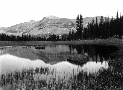
King's Peak, Uinta Mountains, Duchesne County
Area: 3,255 square miles;
Population: 12,537;
County seat: Duchesne City;
Origin of county name: after the Duchesne River which was possibly named for a French Canadian trapper;
Principal cities/towns: Roosevelt (3,842), Duchesne City (1,677), Myton (500), Altamont (247), Tabiona (152);
Economy: livestock, alfalfa and hay, oil, natural gas;
Points of interest: High Uinta Wilderness Area, Starvation Reservoir, Big Sand Wash Reservoir.
Much of present-day Duchesne County was once part of the sprawling Uintah and Ouray Indian Reservation. Today most of the county is owned or controlled by individual Indians or the Ute Indian Tribe.
The Uintah Reservation was created in 1861 by President Abraham Lincoln for the permanent home of the Uintah and Whiteriver Utes. Later, the Uncompahgre Utes were moved to the Uintah and newly created Uncompahgre Indian Reservations. At the turn of the century, both Indian reservations were thrown open to homesteaders under the Dawes Act. This was done after allotments of land were made to Indians of the three tribes. On 1 September 1905 homesteading began in earnest on the former Uintah Indian Reservation.
The settlement of Duchesne County is unique in Utah history, for unlike much of the state, it did not occur under the direction of Brigham Young or the Mormon church. Rather, it was settled by individuals who obtained 160 acres under the federal Homestead Act. Homesteaders were required to prove that they intended to farm the land. After five years of living on the land, making improvements, and paying $1.25 per acre homesteaders were given title to their homesteads.
As was the case in other areas of the state, farmers of the county needed water. The Dry Gulch Irrigation Company was incorporated in 1905 by William H. Smart and Reuben S. Collett to aid farmers in securing water rights from the state and to help them divert water onto their lands from the many streams flowing through the county. Other irrigation companies were also organized. Some were successful, others were not. Homesteaders on Blue Bench, located just north of Duchesne City, organized the Blue Bench Irrigation Company. With financial support from wealthy Jesse Knight of Provo, heroic efforts were made over several decades to divert water from the Duchesne River to farmsteads on Blue Bench. This gallant effort ended in failure for the farmers and financial disaster for Knight.
Duchesne County is bordered on the east and west by Uintah and Wasatch counties respectively, on the north by Summit County, and on the south by Carbon County. In 1914 the legislature created Duchesne County from part of Wasatch County. The county became official with the coming of the new year-1915. The state's highest mountain, Kings Peak (13,528 feet), is located in the county's Uinta Mountains. Major streams running through the county include the Strawberry, Duchesne, Lake Fork, and Yellowstone rivers.
The High Uintas Primitive Area, situated in the northern portion of the county, is dotted with some of the most beautiful alpine lakes anywhere in the West. The lakes are free of ice for only a few months of the year.
The county's economy is based primarily on the livestock industry, but the area is also rich in oil and natural gas. As in Uintah County to the east, Duchesne's oil and natural gas extraction industries fluctuate due to international oil and natural gas markets.