SEVIER COUNTY
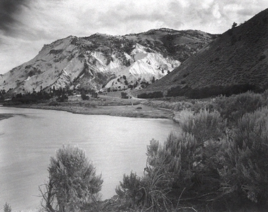
Big Rock Candy Mountain
Area: 1,976 square miles;
Population: 15,431 (1990);
County seat: Richfield;
Origin of county name: after the Sevier River, from the Spanish Rio Severo;
Principal cities/towns: Richfield (5,593), Salina (1,943), Monroe (1,472);
Economy: livestock, manufacturing, trade;
Points of interest: Fremont State Park in Clear Creek Canyon, Fish Lake, Big Rock Candy Mountain, Elsinore White Rock School.
Sevier County is located in the high plateau country of central Utah. Most of the towns lie near the Sevier River in a fertile valley bordered on the west by the Pahvant Range and on the east by the Wasatch and Fish Lake plateaus. National forests cover almost half of the county. The area is seismically active, and a number of earthquakes have centered in the southern part of the county on the Sevier Fault.
Many prehistoric Indian sites have been found. Sudden Shelter, an Archaic site on Ivie Creek, contains the oldest time record in Utah east of the Wasatch--B.C. 5080 to A.D. 1900. Fremont and Sevier Culture sites continue to be found, especially during construction projects. Fremont State Park preserves a recently uncovered Fremont Culture prehistoric village.
Travelers on the old Spanish Trail and mountain man Jedediah S. Smith were among those who crossed the county before white settlement. The Southern Exploring Company under Mormon Church apostle Parley P. Pratt visited the area during the winter of 1849-50, and George W. Bean explored the Sevier Valley in 1863. Early in 1864 ten men settled in the Richfield area, and several other towns were founded in the next few years. However, violent confrontations with the Ute Indians during the Black Hawk War (1865-68) forced the abandonment of all the Sevier settlements in April 1867. Attempts to resettle did not succeed until 1870.
The area settlement thereafter grew rapidly. Richfield, with eight families and twelve men in 1871, had 753 people by 1874 and was on its way to becoming a major regional commercial center and, eventually, the provider of hospital, airport, and other services for a large area. Many of the county's early settlers were Scandinavians, who brought distinctive building styles and cultural practices with them.
The Deseret Telegraph extended its line from Gunnison to Monroe in 1872, providing a vital communications link for the area's larger cities. The Denver and Rio Grande Railroad reached Salina in 1891 and Richfield in 1896, improving the marketing of Sevier County agricultural products. The building of Interstate 70 in the 1980s linked the county to the national freeway system.
Sheep and cattle remain important to the local economy, as do also dairy products, field crops, and, in recent years, turkey raising. Trade and manufacturing--including food processing and building product manufacturing--have contributed to the county's growth as well. Sevier County is the state's leading producer of gypsum, a mineral used in building products such as plaster and plasterboard, which is produced at plants in Sigurd. The county has coal mines and natural gas reserves in the northeast and major geothermal resources that could be tapped for energy production.
A significant impact to the county came in the 1980s with the completion of Interstate 70 through the county, skirting the cities of Richfield and Salina. Construction of the interstate highway uncovered a large Fremont Indian village in Clear Creek Canyon. This led to the establishment of the Fremont State Park, which opened in 1987.
The county is served by three high schools located in Salina, Richfield, and Monroe. The population of the county has shown a continued increase since 1970 when the population was at 10,976 to 1990 when it had climbed to 15,431.