

 UTAH EDUCATION NETWORK

 Justin
 Dani
Dani Rob
Rob Val
Val Kayla
Kayla
Utah National Parks
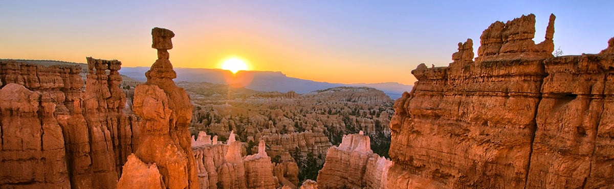
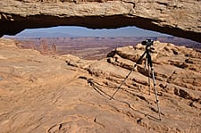
Canyonlands National Park

General Info & Web sites
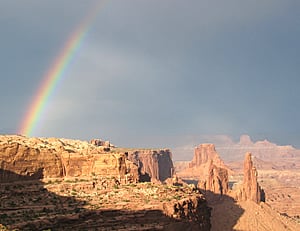 The Canyonlands National Park, located near Moab, Utah, has colorful canyons, mesas and buttes that were carved out by the Colorado River and its tributaries. Canyonlands is divided into three separate districts: Island in the Sky, the Needles and the Maze. While these areas possess a similar desert atmosphere, each has its own unique characteristics.
- U.S. National Park Service
- History and Culture
- Nature and Science
- Curriculum Resources For Teachers
- Utah History Encyclopedia
Maps
- NPS Printable Maps
Printable maps of the different areas of Canyonlands.
- Google Map
Browser based map of the park. Click and drag maps to view adjacent sections immediately. View satellite images of the park that you can zoom and pan.
- The American Southwest
Map of Canyonlands. - MyUtahParks.com
A very specific and useful map of Canyonlands National Park showing roads and entrances.
Photos
- Utah Collections
A collection of pictures, videos and documents related to the park. - nps.gov
US National Park Service photo gallery of Canyonlands. - USGS
Canyonlands National Park: A Photographic Featuring Park Geology
Sights to See
| Average Temperatures | ||
|---|---|---|
| January | 44°F | 22°F |
| February | 52°F | 28°F |
| March | 64°F | 35°F |
| April | 71°F | 42°F |
| May | 82°F | 51°F |
| June | 93°F | 60°F |
| July | 100°F | 67°F |
| August | 97°F | 66°F |
| September | 88°F | 55°F |
| October | 74°F | 42°F |
| November | 56°F | 30°F |
| December | 45°F | 23°F |
- Arches - another fascinating geologic feature of the Needles; Angel Arch, Castle Arch, Fortress Arch and Wooden Shoe Arch are but a few found here. Most arches are well hidden in remote canyons and are reachable only by taking a long hike or a 4-wheel-drive trip.
- Cataract Canyon - view of the Green and Colorado rivers after they meet and undergo a turbulent change and pass furiously through this stretch of white water.
- Grand View Point Overlook - the views encompass 100 miles or more of canyon after canyon.
- Island in the Sky - the highest and northernmost section of the park. Formed of a broad, level mesa, it is bordered on the west by the Green River and on the east by the Colorado.
- The Maze - the westernmost section of the park, the most rugged and the most difficult to access. There are bizarre towers, walls, buttes and mesas in the Land of Standing Rocks, the Doll House and the Fins.
- The Needles District - found in the southeastern section of the park. An area of immense diversity, its arches, spires, canyons, pre-historic Indian ruins and fascinating pictographs vie for the viewer's attention.
- Upheaval Dome - an unusual geologic feature. This stone curiosity does not resemble a dome at all, but rather a meteor crater. Geologists from around the world have come to study it and debate its origin.
- White Rim - a nearly continuous sandstone bench that follows the contours of the mesa.
Biking
Boating
- nps.gov - High Water Videos
Videos of white water rafting in Canyonlands.
Camping
Climbing
- nps.gov
US National Park Service information about climbing in Canyonlands. - Mountain Project
Find climbing areas and routes in Canyonlands National Park and discover photos, user reviews, and detailed route info like climbing type and grade.
Hiking / Backpacking
- Day Hikes
Brief descriptions of some of the best day hikes in Canyonlands National Park. - nps.gov
US National Park Service information about hiking in Canyonlands. - Outdoor Eyes
Downloadable GPS waypoints of the hiking trails in the park.
Horseback Riding
- nps.gov
Private Horse & Mule Riding at Canyonlands
Scenic Drives
- Driving through Canyonlands
Be prepared for sensory overload when driving through Canyonlands National Park. - nps.gov
Canyonlands National Park - Auto Touring